Education voucher at hand? Step into the fast lane: Contact us
Contact us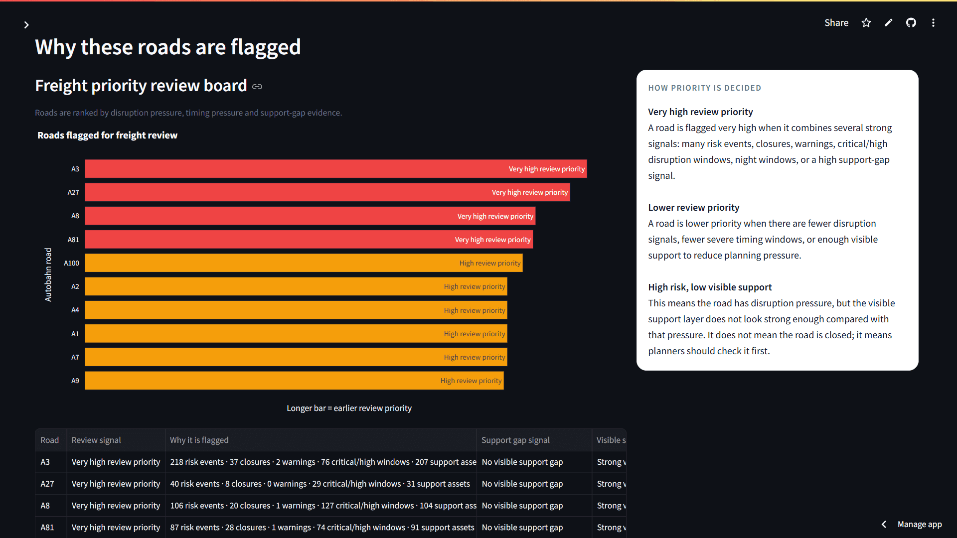
Autobahn Freight Risk Intelligence
Freight planners do not necessarily lack road data. The harder problem is turning scattered information about roadworks, closures, warnings, parking, and charging infrastructure into something that supports a real planning decision. Autobahn Freight Risk Intelligence was built to bring those pieces together.
The project uses the public German Autobahn API to collect information about roadworks, traffic warnings, closures, lorry parking locations, and charging stations. Dynamic road events were collected every two hours, while support infrastructure data was collected daily. The data moves through an end-to-end pipeline built with Python, Apache Airflow, PostgreSQL, dbt, Docker, and Streamlit.
After collection, the raw API records are cleaned and transformed into structured information about affected roads, disruption severity, timing, night and cross-midnight windows, width and speed restrictions, parking capacity, charging power, and exact map geometry. The project combines three main risk sources, they are roadworks, warnings, and closures with two forms of support infrastructure: lorry parking and charging stations.
The final application presents this information through a Freight Risk Command Centre. Users can examine network conditions, identify corridors that need attention, explore upcoming disruption windows, and compare candidate routes using both disruption and support information.
The project does not try to replace a commercial truck navigation system. Instead, it shows how public infrastructure data can be transformed into a practical decision support product that helps planners ask better questions before dispatch:
Where is the pressure? When will it matter? Is another route worth considering? And does the corridor provide enough operational support?
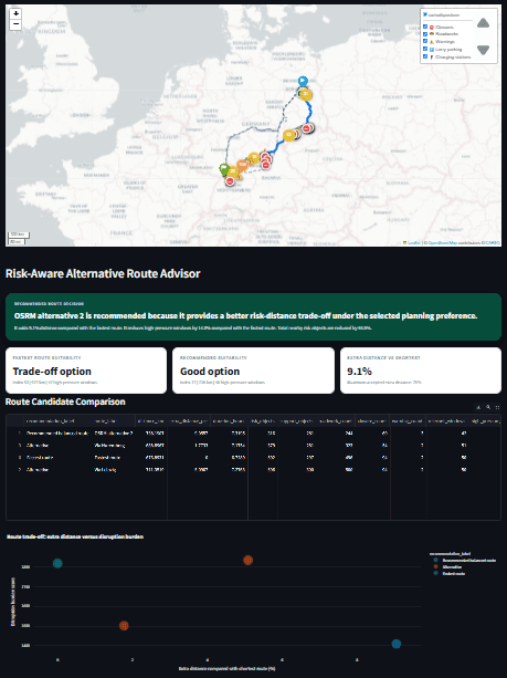
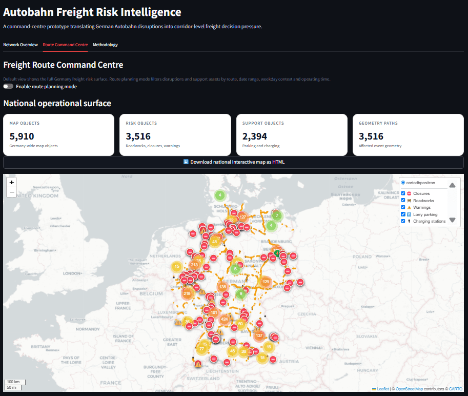
The goal was to turn a complex public API into a tool that feels useful to a freight planner rather than simply displaying traffic data. The project was designed to answer four practical questions: Where are disruptions concentrated? How serious are they? When are they active or planned? And does the affected corridor have enough parking or charging support nearby? To achieve this, the project combines event severity, timing windows, map geometry, and infrastructure information in one application. It also demonstrates the complete technical journey from automated data collection and modelling to validation, deployment, and user facing decision support.
The Team
- Sai Deekshith Reddy PatlollaPortfolio
Sai Deekshith Reddy Patlolla is a data professional based in Berlin with a background in Business Administration and data analytics. He enjoys taking messy, complex data and turning it into something clear, useful, and easy to understand. For his final project at SPICED Academy, he brought together his interest in logistics, operational challenges, and data to build Autobahn Freight Risk Intelligence. He is now looking for opportunities across Germany where he can keep learning, contribute to real projects, and use data to support better decisions.
SocialsLinkedIn
We AI-proof
your career


